Home
Radar
Log in
Home
Canada
Radar
Mountain
World
My account
Log in
Contact us
Search results
See all results
CAN'T FIND YOUR LOCATION?
Request the creation of a location
My location
Recent searches
Clear my history
Favorites
Edit my favorites
Create your account to save your favorites.
Log in
Weather
United States
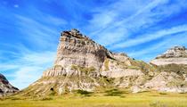
Snowy Range Ski & Recreation Area (ski resort)
WEATHER SNOWY RANGE SKI & RECREATION AREA
Laramie - United States
Thu
23
-
-
Fri
24
-
-
Sat
25
-
-
Sun
26
-
-
Mon
27
-
-
Tue
28
-
-
Wed
29
-
-
Thu
30
-
-
Fri
31
-
-
Sat
01
-
-
Sun
02
-
-
Mon
03
-
-
Tue
04
-
-
Wed
05
-
-
Thu
06
-
-
365
days
Day
Time / Hour
Compare
Today's Forecast
Forecast produced by
Cyrille DUCHESNE
Updated at
18h30
- Next update at
00h30
(local time)
In Short
N.C.
Ski resort info
Weather radar
Hour by hour
Weather comparator
Expert’s summary
Tonight in Snowy Range Ski & Recreation Area, Skies with few clouds. Chance of light rain.
Temperatures will vary between 15 and 22°C.
The reliability of the situation is good.
21:00 to midnight
16°
Feels Like 14°
10 km/h
Gusts
20 km/h
Good weather with few clouds.
Slight risk of showers.
Risk of rain
20 %
Freezing level 0°
5150 m
Snow-rain limit
4850 m
Snow expected
0 cm
Night
13°
Feels Like 11°
due to the wind
10 km/h
Gusts
25 km/h
Unsettled weather becoming clear.
No precipitation.
No risk of rain
Freezing level 0°
5150 m
Snow-rain limit
4850 m
Snow expected
0 cm
Tomorrow's weather
Weekend weather
Receive the weather forecast for my ski resort
Add Weather Crave to your favorite sources
Share
Link copied
Station Info
Closed
Snowy Range Ski & Recreation Area
opening scheduled on 11/12/2026 at 28/03/2027
Snow
N.C.
at the top (2945m)
N.C.
down (2682m)
Snowfall
4 months ago : 5 cm
4 months ago : 22.86 cm
4 months ago : 5.08 cm
Track Info
Lifts
0/5
Snow Parks
0/2
Nordic ski
N.C.
Back skiing
N.C.
Tracks
0
0
0
0
with
Ephemeris
Thursday 23 july
Day
-2 min
Waxing
gibbous Moon
Sunrise
05h48
Sunset
20h29
Apollinaris
Next few days
Tomorrow,
Friday 24
-
|
-
-
-
km/h
This weekend,
Saturday 25
-
|
-
-
-
km/h
Sunday 26
-
|
-
-
-
km/h
Golfs
arround Laramie
Golfs
Ski resort
Airport
Fox Run Golf Course
Jacoby Golf Course
Snowy Range Ski & Recreation Area
Laramie Regional Airport
Near
Snowy Range Ski & Recreation Area
Laramie
Vedauwoo
Pumpkin vine
Buford
Virginia dale
Albany
Four corners
Red Feather Lakes
Rock River
Arlington
Whitaker
Warren af base
Weather United States
Los Angeles
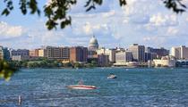
Washington D.C.
San Francisco
New York
Chicago
Milwaukee
Montgomery
Nashville
Oklahoma City
Omaha
Philadelphie
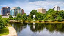
Pittsburgh